A
pleasant early summer pattern
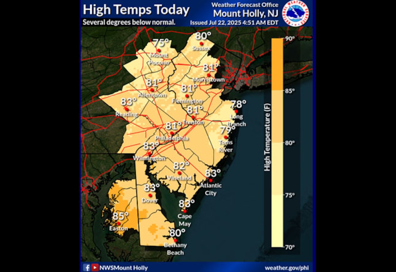
will bring mild temperatures and low humidity to the Lehigh Valley on Tuesday, July 22, with conditions gradually warming through the week and thunderstorms developing by Friday.
High pressure moving from southeast Canada will deliver comfortable conditions Tuesday, with temperatures in the upper 70s to low 80s and dew points dropping into the 50s. Overnight low temperatures will range from the upper 50s to mid-60s, providing excellent sleeping weather with mostly clear skies.
By Wednesday and Thursday, temperatures and humidity will begin to increase. Residents can expect gradually warming conditions with increasing cloud cover, particularly on Wednesday. Winds will remain light, generally from the northeast at five to ten miles per hour.
The weather pattern will shift dramatically by Friday, with a cold front approaching that could trigger scattered showers and thunderstorms. Heat index values may become high enough to warrant potential heat advisories. Precipitation chances will increase through the weekend, with Saturday and Sunday featuring the highest likelihood of thunderstorms.
Long-range forecasts suggest the cold front may stall near the area through the weekend, maintaining unsettled weather conditions, including heavy rainfall. Residents should monitor local forecasts and be prepared for rapidly changing conditions.
more lehigh valley news
-
Dear Abby: Husband keeps in touch with old friend and wife isn’t happy
-
Is Facebook deleting 10M profiles? Here’s what you need to know
-
Bill Cosby and more ‘Cosby Show’ alums react to costar’s death at 54
-
Smirking driver points gun at another driver after merging mishap on Route 22, police say
-
Dear Annie: My son said his mom and I can’t see his baby until she’s 2. I told my wife and she cried.
Our journalism needs your support. Please subscribe today to
lehighvalleylive.com
.
Generative AI was used to produce an initial draft of this story, which was reviewed and edited by
lehighvalleylive.com
staff
.